" La Question n'est pas de Savoir SI il y aura des Cyclones, la Question est de Savoir Quand ... "

HURRICANES HUNTER
WHEATHER FORECAST

... N'hésitez pas à diffuser HURRICANES HUNTER autour de vous ...


mardi 9 juillet 2013

FORECAST DU GFS POUR LE 16 JUILLET 2013 ... HURRICANE DORIAN ?

... ET BEIN ...
 ... SI MAINTENANT LA SAISON DES CAP VERDIENS DEBUTE MI JUILLET ....
 
 
 DEUX JOURS QUE LE GFS INITIE UN CAP VERDIEN POUR LE 16 JUILLET SUR LES PETITES ANTILLES, AVEC UN PASSAGE PLUS NORD QUE CHANTAL (LES SAINTES).
 
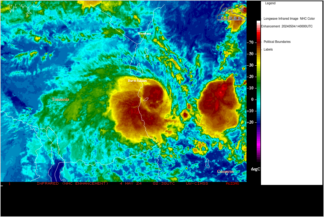
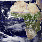
 LA GENESE DE DORIAN ? CETTE ONDE EN SORTIE D'AFRIQUE :
 
 
A SUIVRE SUR HURRICANES HUNTER ...


lundi 8 juillet 2013

ET BEIN ....

VOICI LES PREVISIONS DE GRAY ET KLOTZBACH (MASTER IN HURRICANES) CONCERNANT CHANTAL ET LE RESTE DE LA SAISON CYCLONIQUE ...
BONNE LECTURE.
VOS COMMENTAIRES SONT LES BIENVENUS.

 
I wanted to post this..it just came out from Dr. Masters at WU, referencing Dr. Klotzbach and Gray from Colorado State:
A statement from Dr. Masters this morning –
“Chantal’s formation on July 8 is an usually early date for formation of the season’s third storm, which usually occurs on August 13. A large number of early-season named storms is not necessarily a harbinger of an active season, unless one or more of these storms form in the deep tropics, south of 23.5°N. According to Phil Klotzbach and Bill Gray, leaders of Colorado State’s seasonal hurricane forecasting team,
“Most years do not have named storm formations in June and July in the tropical Atlantic (south of 23.5°N); however, if tropical formations do occur, it indicates that a very active hurricane season is likely. For example, the seven years with the most named storm days in the deep tropics in June and July (since 1949) are 1966, 1969, 1995, 1996, 1998, 2005, and 2008. All seven of these seasons were very active. When storms form in the deep tropics in the early part of the hurricane season, it indicates that conditions are already very favorable for TC development. In general, the start of the hurricane season is restricted by thermodynamics (warm SSTs, unstable lapse rates), and therefore deep tropical activity early in the hurricane season implies that the thermodynamics are already quite favorable for tropical cyclone (TC) development.”
Two of this season’s three storms have formed in the deep tropics–Tropical Storm Barry, which formed in the Gulf of Mexico’s Bay of Campeche at a latitude of 19.6°N, and now Tropical Storm Chantal, which formed at a latitude of 9.8°N. With recent runs of the GFS model predicting formation of yet another tropical storm southwest of the Cape Verde Islands early next week, it appears that the Atlantic is primed for an active hurricane season in 2013.”
Good day everyone!

VOICI LE FORECAST DU GFS POUR LE 15 JUILLET 2013 ... UN CAP VERDIEN AU 45W QUI DEBUTE PAR UNE ONDE EN SORTIE D'AFRIQUE LE 10 JUILLET ...
A SUIVRE ...


NAISSANCE DE LA TEMPETE TROPICALE CHANTAL


...CHANTAL RACING WEST-NORTHWESTWARD TOWARD THE LESSER ANTILLES...

SUMMARY OF 200 AM EDT...0600 UTC...INFORMATION
----------------------------------------------
LOCATION...10.1N 48.5W
ABOUT 775 MI...1245 KM ESE OF BARBADOS
MAXIMUM SUSTAINED WINDS...40 MPH...65 KM/H
PRESENT MOVEMENT...W OR 280 DEGREES AT 26 MPH...43 KM/H
MINIMUM CENTRAL PRESSURE...1007 MB...29.74 INCHES